Volunteers Needed
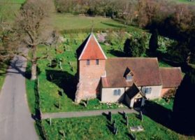
Tadley is designated in the National Monuments Record (England), now known as English Heritage Archive and the Archaeology and Historic Buildings Record as a ‘Deserted Mediaeval Village’. The parish church of St Peter’s stands alone amongst the fields, with most of modern Tadley (post 1600), now a town, situated about a mile to the east. One of Tadley and District History Society’s (TADS) projects is to discover the exact whereabouts of the original village.
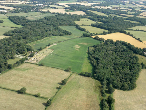
Evidence gathered by TADS so far includes a state paper that mentions the demolishing of a church house and other houses in 1636, archaeological records of a ‘spread of mediaeval activity’ noted during cable work, aerial photographs of the surrounding fields taken from aircraft and a mobile mast, and a preliminary field walk of a copse behind the church to look for clues of habitation.
Photographs indicate a possible field system adjacent to Tadley Place and a ‘linear feature’ across a field between St Peter’s Church and Tadley Place. It seems logical that the original houses would have been dotted around the vicinity of the church and manor. However, the precise location of any mediaeval buildings has yet to be discovered. It now seems that archaeological techniques, such as field walking, and the use of specialist techniques, such as geophysics, will be the only way of gaining further evidence for the location of the lost village.
TADS is very keen to assist in locating the original site of Tadley village and would love to hear from anyone who would like to join the project and help organise the archaeological activities. TADS members will be able to lend a helping hand. Perhaps it would be a suitable project for a student in archaeology or history? It is possible that any finds would not be just mediaeval but from other periods as well (for example, the Portway Roman road crosses the field opposite St Peter’s Church).